Mapping Sustainability: How GIS and Remote Sensing Are Transforming Charcoal Production Monitoring
In sub-Saharan Africa, firewood and charcoal are the primary energy sources for over 80 percent of the population (World Bank, 2011). However, much of this charcoal is produced unsustainably, leading to severe deforestation across the region.
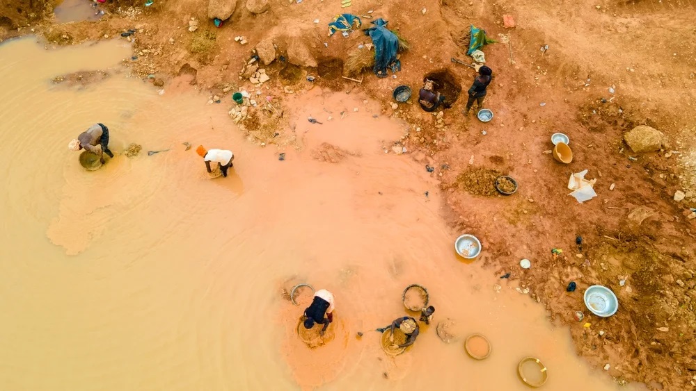
In Ghana, charcoal remains a popular and affordable choice for cooking and heating in urban areas, but its production is putting immense pressure on forest resources.
To address these challenges, the Centre for Remote Sensing and Geographic Information Services (CERSGIS), a member of the SERVIR West Africa consortium, is working alongside local governments and non-governmental organizations to develop a Charcoal Production Monitoring Service. This initiative aims to create a sustainable charcoal value chain by leveraging Earth Observation technology and enhancing local capacity.
Through a collaborative approach, CERSGIS is co-designing and co-developing a web-based monitoring and decision-support portal for charcoal production sites. This service is being rolled out in close coordination with national, district, and traditional authorities to ensure widespread support and effective implementation.
Using free and open-source satellite data, the Charcoal Production Monitoring Service provides comprehensive spatial data on all charcoal production sites within project districts in the savanna landscape, equipping decision-makers and partners with the tools they need to target areas for remediation and landscape restoration. Additionally, the initiative includes training for stakeholders in rural communities on how to use a mobile application to map and monitor current production sites.
To date, the Charcoal Production Monitoring Service has identified over 7,000 charcoal scars and kilns. This data has been used to create detailed scar and kiln density maps for the production districts, providing valuable insights into the ground conditions of these areas.


Embracing Sustainable Production Practices at the Community Level
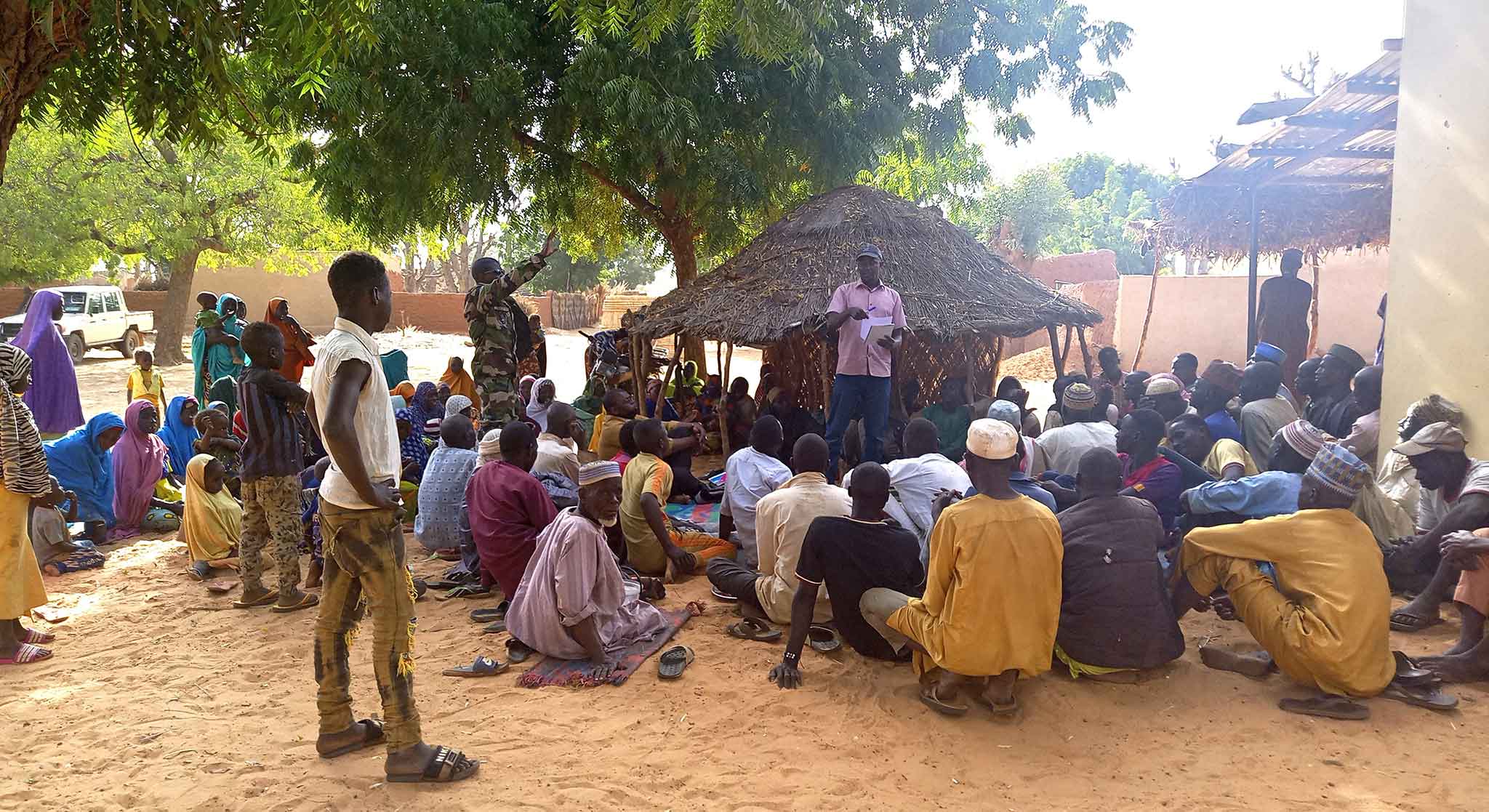
Effective community engagement, particularly in challenging areas, hinges on strong partnerships with local stakeholders. In this regard, the Ghana National Fire Service and A Rocha Ghana have been instrumental as liaisons, facilitating access and communication to ensure that even the most remote neighborhoods are included in community initiatives.
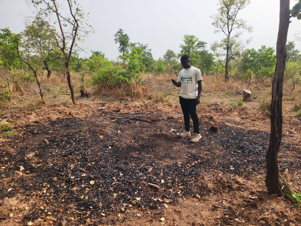
A Rocha Ghana’s innovative approach of using charcoal production site information to select and support sustainable farmers in the West Gonja District demonstrates a successful model of combining environmental conservation with economic development. Farmers who avoid charcoal production on their lands are provided with organic cassava seedlings and are supported in accessing premium markets. This initiative not only boosts farmers’ incomes but also promotes sustainable agricultural practices, contributing to long-term environmental protection.
“Off-takers often purchase cassava at low prices, forcing farmers to let their produce go to waste. However, thanks to A Rocha Ghana’s intervention, farmers can now access markets and companies that offer premium prices for their cassava,” shared Mrs Jacqueline Mbawine, Monitoring, Evaluation and Reporting Manager at A Rocha Ghana.
A Rocha Ghana has also received kiln density maps from CERSGIS, which serve as a reference for targeting and intensifying its tree restoration efforts in charcoal-producing areas, especially in the West Gonja District.
“Identifying the areas most impacted by charcoal production enables us to strategically plan our reforestation efforts,” added Mrs Mbawine. “In 2023, A Rocha Ghana planted 40,000 trees, restoring approximately 324 hectares of land in the district. This initiative is designed not only to rehabilitate degraded landscapes but also to create sustainable livelihoods for local communities, enhance biodiversity, and combat the harmful effects of deforestation and climate change.”
Another important partner of the SERVIR West Africa initiative is the Energy Commission of Ghana. The Commission is now utilizing data and maps, including charcoal scar distribution and kiln density maps, to make more informed decisions and regulations. As the regulatory authority for the energy industry, the Commission relies on this information to oversee both legal and illegal energy production activities.
“Using data from earth observation technologies to monitor charcoal production sites provides us with the necessary information to enforce woodfuel regulations effectively. We greatly appreciate the ongoing provision of data and access to information, particularly when conducting field visits in high charcoal production communities,” noted Mr John Yeboah, Senior Manager of Renewable Energy Regulation at the Energy Commission, Ghana.
“The kiln density maps provided by CERSGIS give us a comprehensive view of charcoal production distribution within the municipality, which is closely linked to the occurrence of unregulated bushfires. With this valuable information, we can intensify our training programs for rural fire volunteers. These programs are crucial for equipping volunteers with the skills and knowledge needed to effectively manage and prevent unforeseen bushfires. By understanding the hotspots of charcoal production, we can better allocate resources, anticipate potential fire outbreaks, and implement preventive measures to protect our communities and the environment,” emphasized Mr Twum Prempeh, Kintampo North Fire Service Commander, Ghana.
The impact of this initiative is evident in the proactive steps taken by organizations like A Rocha Ghana, the Energy Commission of Ghana, and the Ghana National Fire Service. These organizations are now leveraging the data to conduct restorative activities and enforce regulations. Testimonials from various key stakeholders highlight the value of this data and its positive influence on sustainable energy regulation and environmental conservation.
This article is made possible by the generous support of the American people through USAID and NASA. SERVIR WA is responsible for its contents, which do not necessarily reflect the views of USAID, NASA, or the United States Government.