SERVIR WA to Support Commune-Level Development Planning in Burkina Faso
In rural communities, women play a crucial, yet often overlooked, role in agricultural production and sustainable land management. Women’s associations, if provided with equitable opportunities, are poised to drive significant economic development through traditional and innovative utilization of natural resources.
Recognizing this, the SERVIR West Africa (SERVIR WA) program, supported by USAID and NASA, and implemented by ICRISAT and partners, is leveraging Earth Observation data and geospatial tools to identify and amplify economic opportunities for women in select municipalities.
As part of its commitment to communal-level services in Burkina Faso, SERVIR-WA, in collaboration with ISESTEL (Institut Supérieur d’Études Spatiales et Télécommunications), is developing a platform to bolster communal development plans by providing precise data and information on land occupancy (land use, land cover), levels of land degradation, infrastructure, and income-generating opportunities for women from natural resources.

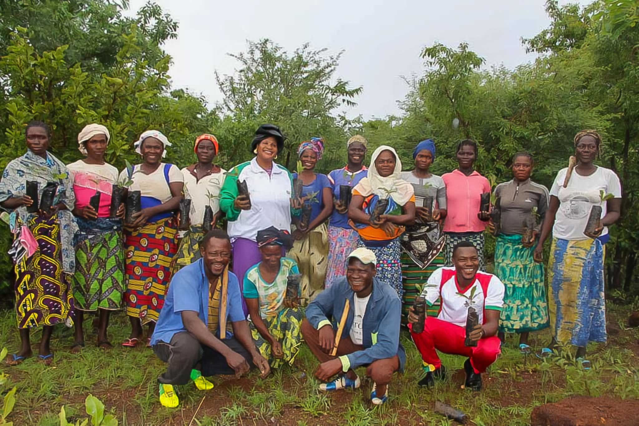
Women participate in a training on reforestation
In recent years, data and information have been produced and stored in an accessible geoportal platform, and users were trained in data processing and implementation. These users can be categorized into three main groups:
Classic End-Users and Decision-Makers: This category comprises individuals who not only utilize the data but also hold decision-making authority. Their engagement is crucial for ensuring effective utilization and sustainability of the platform.
Technical Services: Consisting primarily of institutions dealing with environmental concerns such as the Livestock Department and Agriculture Department, these entities play a pivotal role in leveraging the platform to address various environmental challenges.
Community Engagement: Beyond institutional stakeholders, community involvement is integral to the platform’s success. Educated youth, organized into clubs to support data collection and production, contribute significantly. Additionally, the participation of traditional chiefs and women’s associations across all communes underscores the inclusive nature of the initiative.
“Since 2019, the SERVIR WA program has facilitated the collection of data. Women’s participation in this process was essential,” noted Ms Gertrude Gossogo Toé, Association Yilimdé. “New technologies are becoming more prevalent and our associations are mainly composed of women who are not sufficiently familiar with computer tools. Therefore, capacity building in data collection and processing was highly beneficial to the project.”
In addition, land degradation neutrality (LDN) has been measured for all the communes to indicate the level of effort needed for sustainable communal development. A network of stakeholders, including women and educated youth, is being developed to support communal development through women’s associations and SERVIR Clubs. By the end of 2024, the service aims to reach an Application Readiness Level 5, with land use plans and local charters geared to improve current LDN values. This involves sensitizing and training actors on LDN objectives and risks incurred with old land use practices through seminars and workshops, disseminating best land utilization practices and the national strategy of land restoration, conservation, and improvement for Burkina Faso.
The anticipated outcome is enhanced end-user capability in utilizing geospatial technologies for data collection, processing, dissemination, and sharing with online users.

Women stand in front of their association headquarters in Burkina Faso
Case Study: Geolocation and Activity Mapping of Women’s Associations in Burkina Faso
In 2023, a geolocation of women’s associations and activities was conducted across seven pilot communes, namely Bobo Dioulasso (districts 2 and 5) and Péni (Haut-Bassin region); Dano (South-West region); Barsalogho (Mid-North region); Ouarkoye (Boucle du Mouhoun region); Yamba (East region) and Léo (Mid-West region).
As part of this process, a total of 41 women’s organizations, comprising 1,100 members across five provinces, were identified and inventoried using a participatory approach involving stakeholders and community leaders.
The results from this study, shared via an online platform developed by ISESTEL, highlight that the primary income-generating activities of these organizations, in the targeted communes, include processing and marketing of non-timber forest products (NTFPs), saponification, and weaving. Crucially, these findings underscore the significant role women’s associations can play in achieving land degradation neutrality (LDN) if they are further empowered through appropriate strategies and initiatives.

Members of a Women’s Association display their community savings
The interactive online database mapping the geolocation of activities also provides valuable insights for local decision-makers, development agencies, and technical partners, enabling them to implement targeted interventions that enhance women’s roles in the development of rural communities in Burkina Faso.
The study further emphasizes the need to expand women’s contributions to reforestation efforts of degraded lands, wetlands, riverbanks, and low slopes, which can significantly contribute to LDN goals.
Another crucial area where women’s groups are already making a pivotal impact is in building rural businesses around non-timber products derived from fruit trees, with shea trees identified as particularly valuable assets offering ample opportunities for women entrepreneurs. To ensure the sustainability and scalability of such enterprises, the study recommends expanding their collection areas and tapping into potential market growth.
Finally, to ensure that women’s associations emerge as proactive entrepreneurs driving rural development, SERVIR WA will support in defining appropriate LDN levels following their geolocation. The aim is to initiate or support the innovative utilization of natural resources and collective action, enabling women not only to secure livelihoods for themselves but also to contribute to LDN goals and the broader socio-economic development of their communities.
“Income generated by women’s activities holds immense potential for communal development, provided that these activities are sustainable and align with LDN principles. Planting species such as Vitellaria paradoxa and Parkia biglobosa not only aids in natural regeneration but also enhances terrestrial coverage and carbon sequestration. Moreover, this opens doors for women to explore new income-generating avenues, such as entering the carbon market with natural products” explained Professor Patrice Sanou, Director of ISESTEL and Study Lead.
“Training on land degradation neutrality is a crucial step in raising awareness within our community about the importance of conserving our environment. Through these trainings, our community will be better equipped to promote sustainable practices and mobilize efforts towards a sustainable environment by planting trees and participating in the carbon neutrality market”, said Mr Adama Belle, Environmental Inspector.
Some key findings of the study:
- Women-led organizations’ activities in target communes include both unpaid (meetings, awareness) and paid (production, trade) activities.
- 71% of women’s associations are tax-exempt, with most taxes being municipal taxes.
- 90% have access to credit, mainly from microfinance institutions.
- 78% have access to savings, mainly through MFIs and savings cooperatives.
- Partners include NGOs, government agencies, and microfinance institutions.
The women’s associations’ geolocation data are now available online at the following link: http://servir.isestel.org.
The SERVIR-West Africa (SERVIR-WA) program, funded by USAID and NASA, aims to leverage Earth Observation data and geospatial tools for development in West Africa. This geolocation is part of the program’s communal level service implemented by ISESTEL in Burkina Faso’s rural areas.
Header image: Collective effort towards reforestation. Photos: P. Sanou, ISESTEL.


